
Bay Area
Is the Bay Area Prepared for Major Wildfires?
As part of a Smart and Connected Communities project, funded by the National Science Foundation, the team is also developing virtual games that will help educate the public about wildfire readiness. The project is led by Kenichi Soga, the Donald H. McLaughlin Chair in Mineral Engineering and Chancellor’s Professor at Berkeley, and includes faculty collaborators from the Berkeley’s College of Engineering, College of Environmental Design and Rausser College of Natural Resources.
A UC Berkeley-led team is using computer simulations to stress-test the region’s disaster preparedness and creating virtual games to educate the public about wildfire safety.
By Kara Manke
UC Berkeley News
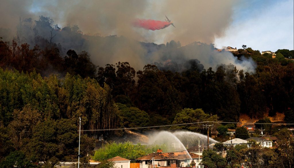
As wildfires continue to rage in LA, many San Francisco Bay Area residents are asking themselves if a similar disaster could happen here — and, with haunting photos of abandoned vehicles in the Pacific Palisades still fresh in everyone’s minds, if vulnerable communities are prepared for a rapid evacuation and firefight.
Since 2022, a team of UC Berkeley researchers, in collaboration with scientists at UC Davis and UC Santa Cruz, has been creating highly detailed models of emergency response infrastructure in two Bay Area communities to answer questions like those.
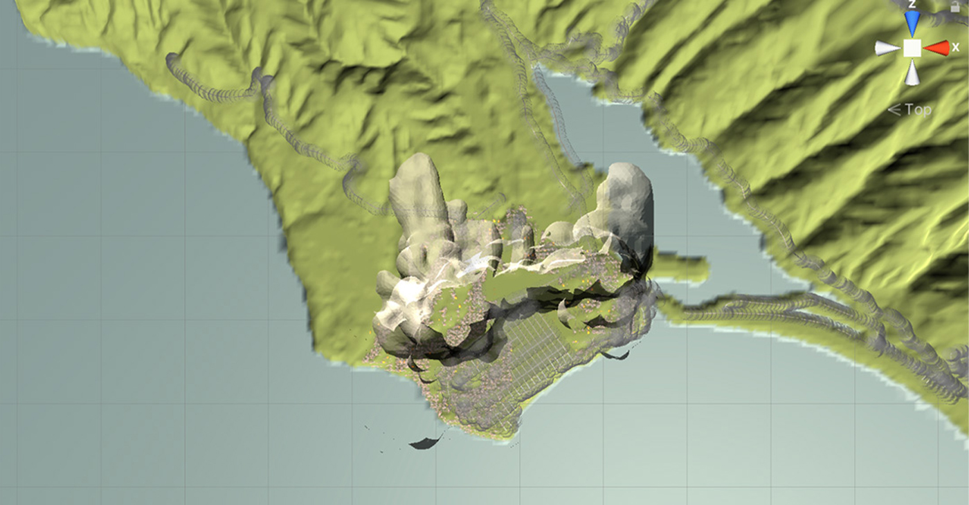
These “digital twins” of Marin and Alameda counties will include communication networks, emergency services and physical infrastructure, as well as information about how different services are operated and managed. The goal of the project is to use these models to simulate wildfire evacuations under different scenarios and identify potential weaknesses.
As part of a Smart and Connected Communities project, funded by the National Science Foundation, the team is also developing virtual games that will help educate the public about wildfire readiness. The project is led by Kenichi Soga, the Donald H. McLaughlin Chair in Mineral Engineering and Chancellor’s Professor at Berkeley, and includes faculty collaborators from the Berkeley’s College of Engineering, College of Environmental Design and Rausser College of Natural Resources.
To learn more about wildfire risk in the Bay Area and how simulations and “mini-games” can help the region prepare, UC Berkeley News spoke with Louise Comfort, project co-principal investigator, professor emerita and project scientist with the Department of Civil and Environmental Engineering.
Firefighters work to contain a grass fire that broke out in the Oakland Hills on Oct. 18, 2024. Noah Berger/AP via UC Berkeley News.
UC Berkeley News: Are Bay Area communities at risk of experiencing wildfires as destructive as those currently impacting LA?
Louise Comfort: Absolutely. The Bay Area has a record of experiencing wildfire in the wildland urban interface, or areas where human development intermingles with undeveloped wildland or vegetation, approximately every 20 to 30 years. Bay Area communities have made major investments in training, preparedness and public education since the last major conflagration in 1991, but we have minor fires, such as the Keller Fire in Oakland on Oct. 20. 2024, relatively frequently. Fortunately, a well-trained Oakland Fire Department responded quickly to contain the Keller Fire, but wind-driven wildfire is a continuing threat to the region.
UC Berkeley News: Compared to L.A., does the Bay Area have any particular strengths or weaknesses when it comes to wildfire preparedness, in terms of susceptibility to severe fire, evacuation routes and communication, insurance coverage, etc.?
Louise Comfort: One strength is the emerging consensus among Bay Area cities that they need to collaborate to reduce wildfire risk, and further, that they need to engage residents in this shared task. There is a new regional agreement, formed just in March 2024, among a set of Bay Area jurisdictions to collaborate on wildfire risk reduction. It is called the East Bay Wildfire Coalition of Governments, with nine member jurisdictions and growing. This is an important step for local governments to pool knowledge, information, resources and plans to prepare for wildfires and other natural hazards to which all jurisdictions are exposed.
Bay Area cities are made vulnerable by structural limitations of their transportation network: four bridges, a BART train that runs part way around the Bay, limited roadways among the counties, and specific points of likely congestion. For example, if the Caldecott Tunnel is closed between Alameda and Contra Costa counties, or if the Richmond Bridge is blocked to the North Bay region, evacuation is quickly limited. Evacuation routes are problematic and dependent on other infrastructure systems, electrical power, communications, and gasoline distribution — all of which are vulnerable to wind-driven wildfire.
UC Berkeley News: The Smart and Connected Communities project is creating “digital twins” of two Bay Area cities to understand how they’d perform when evacuating during a natural disaster. What is a digital twin, and how will it help you understand the Bay Area’s preparedness for severe wildfire events?
Louise Comfort: A “digital twin” is a computational model of an existing urban community. It is intended to replicate technical systems of infrastructure, including road networks, water distribution systems and electrical and gasoline distribution systems. It also models how things flow through these different networks: how vehicles travel the road network, how water flows through the network of water pipes, and how electrical power and gasoline travel through their respective distribution systems. We are currently integrating these technical systems with the organizational systems that manage these functions.
The intent is to test out scenarios computationally that are too dangerous or costly to test in real time. We hope to identify the strengths and weaknesses of our present organizational, institutional, and technical infrastructures before an extreme event — wildfire, earthquake, tsunami, atmospheric river rainstorm or flooding — occurs, so we can anticipate possible scenarios for mitigating these risks or respond quickly to reduce the impact when they do.
Louise Comfort: UC Berkeley News: How do you hope to engage communities to build awareness of risks of preparation?
Louise Comfort: We have done a series of semi-structured interviews with community leaders, public managers, and administrators in public organizations, like schools, parks, and hospitals to identify networks of communication and collaboration within communities, as well as gaps in social interaction that limit full community response.
We are working with a talented team of computer scientists at UC Santa Cruz who have developed a series of “mini-games,” or simulated games that illustrate common dilemmas that people face when encountering a wildfire situation. Such simulations enable people to think through dilemmas before the wildfire occurs, identify alternatives for action in a specific context, and connect with neighbors in a shared task of enabling everyone to evacuate safely.
We hope to hold a public community meeting in late spring 2025 and invite people to come and play the games and give us feedback. We also will make the mini-games available for use in small groups, such as Fire Safe Councils, so members of a neighborhood group can play the game together and think about strategies of risk reduction for their neighborhoods.
UC Berkeley News: Could this model be applied to other disasters that threaten the Bay Area, like sea level rise, flooding or earthquakes?
Louise Comfort: Absolutely. The task is the same for any hazard — wildfire, earthquakes, flash floods, landslides — even if the specific actions may differ by hazard. It means recognizing the risk in a specific context, then determining what resources are available to an individual, household, neighborhood, municipality or county to reduce that risk. It means understanding the risk in one’s specific neighborhood and determining what options are available to manage that risk. These are practical steps that greatly increase a community’s capacity for collective action under threat.


Activism
Oakland Post: Week of March 18 – 24, 2026
The printed Weekly Edition of the Oakland Post: Week of March 18 – 24, 2026
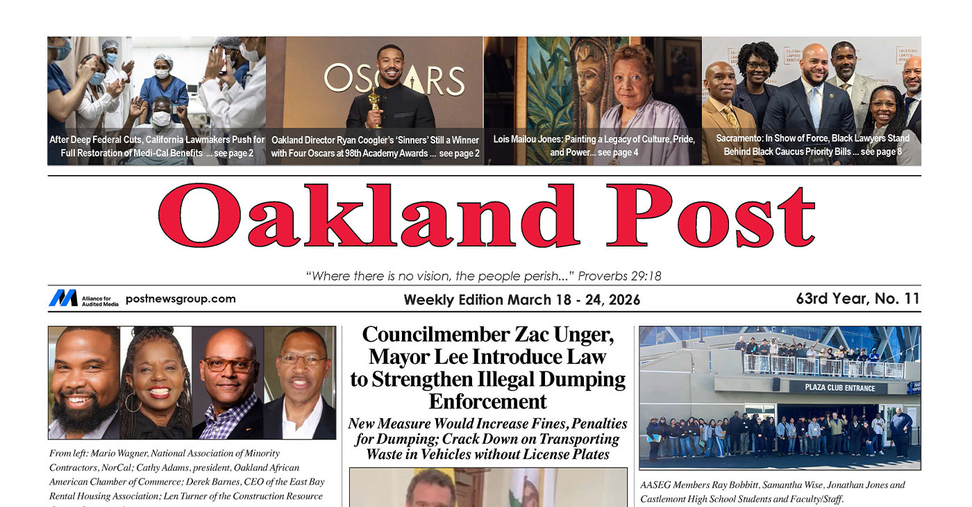
To enlarge your view of this issue, use the slider, magnifying glass icon or full page icon in the lower right corner of the browser window.
Activism
Oakland Post: Week of March 11 -17, 2026
The printed Weekly Edition of the Oakland Post: Week of March 11 – 17, 2026
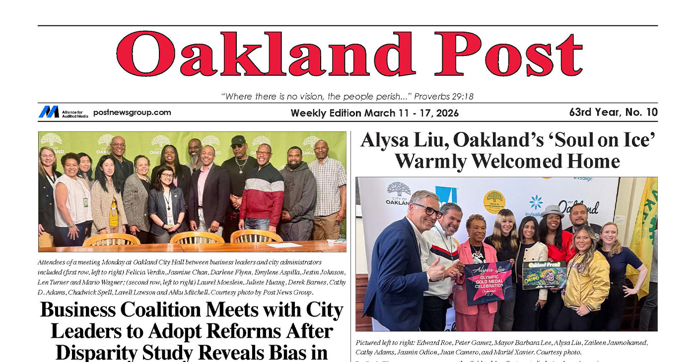
To enlarge your view of this issue, use the slider, magnifying glass icon or full page icon in the lower right corner of the browser window.
Activism
Oakland Post: Week of March 4 – 10, 2026
The printed Weekly Edition of the Oakland Post: Week of March 4 – 10, 2026
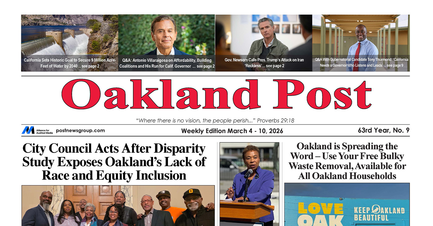
To enlarge your view of this issue, use the slider, magnifying glass icon or full page icon in the lower right corner of the browser window.

WORK FROM HOME
Home-based business with potential monthly income of $10K+ per month. A proven training system and website provided to maximize business effectiveness. Perfect job to earn side and primary income. Contact Lynne for more details: Lynne4npusa@gmail.com 800-334-0540
![]()

Black Artists in America, Installation Three Wraps at the Dixon Gallery and Gardens

Grief, Advocacy, and Education: A Counselor Reflects on Black Maternal Health

Future of Florida’s Black History Museum in Limbo

New Research Shows the Many Benefits of Early Learning

South Hampton K-8 Students Among Top 10 Finalists for Samsung’s ‘Solve for Tomorrow’ Competition

Cuba: No Negotiation with US on the President or Political System

Brooklyn Academy of Music Names Jamaican-Born Tamara McCaw as President

Trinidad & Tobego – U.S. Launches WhatsApp Channel for American Citizens in the Country

Oakland Post: Week of March 18 – 24, 2026

AI Innovation vs. Ethics and Environmental Impact

AI, Web3, and Digital Reparations

What If You Owned Your AI Agent?

Season 7, Episode 3 – January Reporter’s Roundtable 📱

Season 7, Episode 3 – January Reporter’s Roundtable

AI, Media, and Power | Part 2, Real-World Impacts and Tradeoffs

Reflecting on Black History Milestones in Birmingham AL

CITY OF SAN LEANDRO STATE OF CALIFORNIA PUBLIC WORKS DEPARTMENT ENGINEERING DIVISION NOTICE TO BIDDERS FOR ANNUAL STREET OVERLAY/REHABILITATION 2019-21 – PHASE III

Oakland Post: Week of February 18 – 24, 2026

Oakland Post: Week of February 25 – March 3, 2026

PRESS ROOM: NBA Hall of Fame Nominee Terry Cummings Joins 100 Black Men of DeKalb County to Launch Victory & Values Initiative

Trump’s MAGA Allies are Creating Executive Order Plan to Steal the 2026 Midterms

Oakland Post: Week of March 4 – 10, 2026

Chase Oakland Community Center Hosts Alley-Oop Accelerator Building Community and Opportunity for Bay Area Entrepreneurs

U.S. manufacturing rebounds – how foundry services are adapting to rising demand

Poll Shows Support for Policies That Help Families Afford Child Care

OP-ED: One Hundred Years of Black Workers Telling the Truth

Advancements in solar technology that are changing the way we power the world

Woman’s Search for Family’s Roots Leads to Ancestor John T. Ward – A Successful Entrepreneur and Conductor on the Underground Railroad

Oakland Post: Week of March 11 -17, 2026

COMMENTARY: Women of Color Shape Our Past and Future

Hyundai Ioniq 5 Parking, Safety, and 360 View #shorts

2025 Ioniq 5 New Wiper & Powerful Performance! #shorts

Electric SUV Range: Is 259 Miles Enough? #shorts

EV Charging: How Fast Can You Charge an Electric Vehicle? #shorts

Biometric Cooling… Messaging Seats…Come on! 2025 Infiniti QX80 Autograph 4WD

Charged Up: Witness the Magic of a Fully Electric Car! #shorts

Range Rover Sport PHEV Included…: See What’s Inside This Luxury SUV! #shorts

Invisible Hood View: Perfect Parking with X-Ray Vision! #shorts

AI Is Reshaping Black Healthcare: Promise, Peril, and the Push for Improved Results in California

ESSAY: Technology and Medicine, a Primary Care Point of View

Sanctuary Cities

The RESISTANCE – FREEDOM NOW

STATE OF THE PEOPLE: Freddie

ECONOMIC BOYCOTT DAY!!!!!

I told You So
-
 Activism4 weeks ago
Oakland Post: Week of March 4 – 10, 2026
-
 #NNPA BlackPress4 weeks ago
Woman’s Search for Family’s Roots Leads to Ancestor John T. Ward – A Successful Entrepreneur and Conductor on the Underground Railroad
-
 Activism3 weeks ago
Oakland Post: Week of March 11 -17, 2026
-
 #NNPA BlackPress4 weeks ago
COMMENTARY: Women of Color Shape Our Past and Future
-

 #NNPA BlackPress4 weeks ago
Advocates Raise Alarm Over ICE Operation, MOU and Detention Risks in Baltimore County
-

 Advice3 weeks ago
Financial Wellness and Mental Health: Managing Money Stress in College
-

 #NNPA BlackPress4 weeks ago
Pete Buttigieg to Join Mayor Randall Woodfin for Community Town Hall in Birmingham
-
 Activism2 weeks ago
Oakland Post: Week of March 18 – 24, 2026